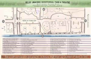
View the self-guided tour brouchure and map here, or stop by the Bicentennial Park Complex and pick up your own copy.
In the 1960’s HUD (Housing Urban Development) at the invitation of the City, cleared all of the buildings for five blocks along the west side of the waterway. As in many early river towns many of them needed to be demolished but some of them should have been saved for their historic value. If this would have happened today we are sure that officials would have the wisdom to protect them.
In the 1980’s though all of the buildings were gone the Will-Joliet Bicentennial Corporation decided to try to revive and preserve their memory by placing large boulders at certain sites. Bronze plaques were then mounted to the boulders telling of historic events where our early merchants and artisans established their homes and businesses. The boulders are beautified by park volunteers who “adopt” an individual boulder, landscape it and maintain it during the growing season. Placed throughout the Park they form a Historic Walk On Bluff Street.
Plaques representing the following can be found.
- Wagner home & Wagon Shop 1860’s
- Bicentennial’s 100 year time capsule 1976
- Catalpa grove from 1870’s
- River from 1673-1933
- McKee’s Mill & Dam 1834
- Our bridges 1832-1933
- Old Bush Block
- Centennial Marker 1936
- Joliet’s first home 1832-1833
- Porter’s Brewery 1858 to Prohibition
- Will County’s first “Courthouse” 1836
- Joliet’s first stone building 1834-1835
- Joliet’s first business center 1836
- Potawatomi Prairie Band
- Businesses of 1870’s
- Demmond’s first house & store 1834
- Homes & Businesses 1870’s
- Joliet’s oldest construction 1837
- Early stagecoach routes
- Old Sac Indian Trail
- Businesses from 1860’s
- Merchants’ Row 1837
- Tinner Blair 1836
- German Loan & Savings Bank 1875
Bluff Street Historic Walk Map


